

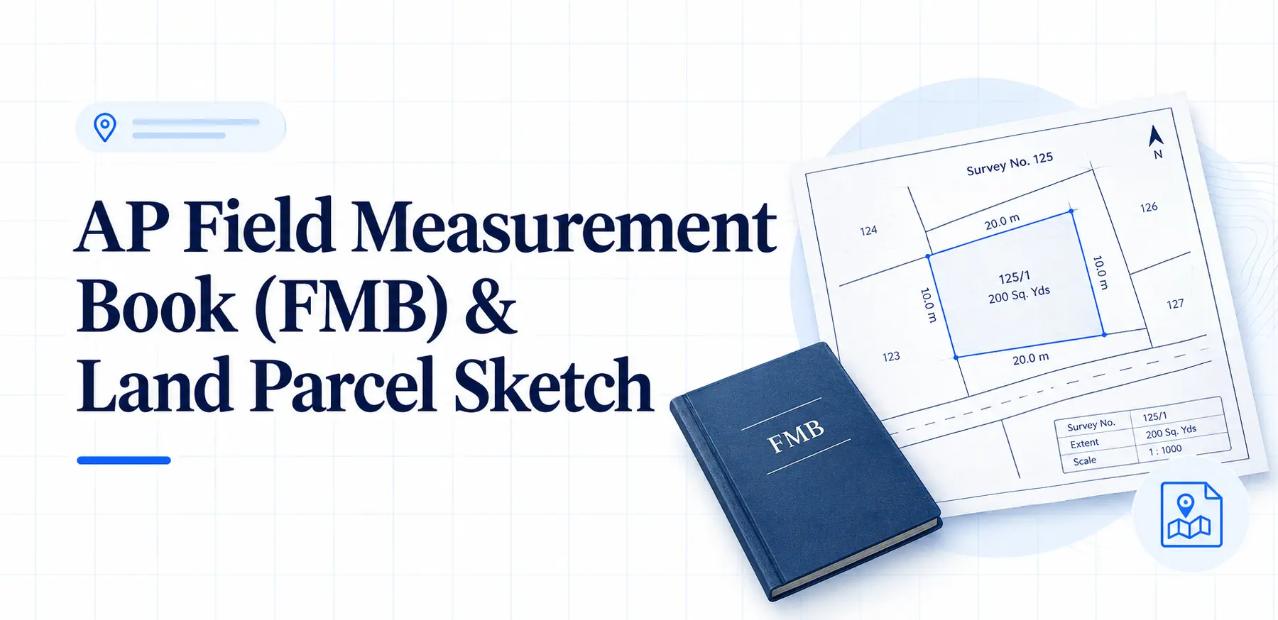
Your land is 200 square yards. The seller says so, the neighbours agree, and the plot looks right. Then the surveyor arrives with the Field Measurement Book and points out that the boundary line runs two feet inside the compound wall you just built.
Or worse the bank rejects your loan application because the FMB sketch on record does not match the dimensions in your sale deed.
This article covers what an FMB is, what the Land Parcel (LP) sketch shows, how to pull these records from BhuNaksha and MeeBhoomi, and how to read the sketch well enough to spot trouble before it costs you money.
What Is an FMB and Why Does It Matter?
A Field Measurement Book is a government record containing survey sketches of individual land parcels in a village. It shows the shape, dimensions, boundaries, and often the neighbouring survey numbers.
In Andhra Pradesh, the FMB is commonly called the Land Parcel (LP) map, and most district portals use the terms interchangeably.
Here is what catches people off guard: the FMB is not an ownership document.
It is a boundary and measurement record. Ownership comes from the sale deed, pattadar passbook, or the Record of Rights.
The FMB answers a narrower but critical question where exactly does your land begin and end?
That question matters more than most buyers realise. Fencing, subdivision, construction, and neighbour disputes all begin with boundaries.
When a bank sanctions a loan against property, the valuation officer checks the FMB against the physical site.
When a sub-registrar processes a partition, the subdivision must exist in the survey records.
Each FMB sketch typically covers one survey number or a sub-division within it. Sketches are drawn to a scale often 1:1,000 or 1:2,000 based on measurements taken during the original government survey.
As land gets subdivided through inheritance or sale, new sub-division numbers are created, and each should have its own FMB record.
If it does not, a fresh survey is usually required before any transaction can proceed cleanly.
You may also like to read these posts : 👇
Karnataka RTC Online & Bhoomi Portal – Full Guide
Gujarat Village Map & 7/12 Utara Online: Survey Number & TP Records
Haryana Jamabandi Map & Digital Land Records
Understanding the Land Parcel (LP) Sketch
The LP sketch serves the same purpose as the FMB a graphical record of a land parcel with its boundaries and measurements.
The difference between the two, where one exists, is administrative: it reflects how records were digitised across different districts and portals.
What you will find on an LP or FMB sketch includes the survey number, sub-division number if applicable, the land extent, and the boundaries as recorded during survey.
Some sketches label adjacent survey numbers, which helps you physically locate the parcel when you are standing on the ground.
Digitised versions may carry coordinates or geo-referenced data that overlays the parcel on satellite imagery.
For buyers, the value is in verification. Compare the FMB boundaries with what exists on-site.
If the seller claims 200 square yards but the sketch suggests less, that gap needs an explanation.
If the sketch shows a road, canal, or government land cutting through the parcel, confirm it on the ground.
These details rarely appear in a sale deed, but they determine what you can actually build or fence.
How to Access AP FMB and Land Maps Online
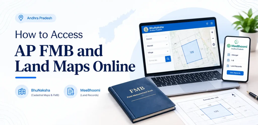
Andhra Pradesh makes land map records available through two portals: BhuNaksha and MeeBhoomi. Both are free for viewing and downloading basic records.
Certified copies the ones banks, courts, and sub-registrar offices accept must come from the revenue office.
Step-by-Step: Viewing FMB and Cadastral Maps on BhuNaksha
BhuNaksha, developed by the National Informatics Centre, is the primary online tool for cadastral maps and FMB data in Andhra Pradesh.
- Open the BhuNaksha Andhra Pradesh portal in your browser. The interface works in English and Telugu.
- Select district, mandal, and village from the dropdowns. If you do not know the mandal or village name, check your property tax receipt or pattadar passbook both carry these details.
- Enter the survey number. If you only know the owner’s name, look up the survey number first through MeeBhoomi’s Adangal or 1-B records.
- View the map. The portal displays the village cadastral map with the selected survey number highlighted. Zoom in to see sub-division details.
- Access FMB data. Look for a “Field Measurement Book” or “FMB” option within the portal. The FMB print option usually appears alongside the map view.
- Download or print. The map and FMB report can generally be saved as a PDF.
Two pitfalls trip people up here. First, the survey number on your old passbook may not match the current portal records if the land was subdivided years ago in that case, search by the new sub-division number or check the village map to identify the correct parcel.
Second, BhuNaksha sometimes loads slowly or shows a blank map during peak hours; if the map does not render, try a different browser or return later in the day rather than assuming the record is missing.
You may also like to read these posts : 👇
West Bengal Mouza Map, RS Khatian & Porcha Guide
Maharashtra 7/12 Ferfar, Satbara & Index 2 Land Records
Odisha Land Records – Bhulekh Naksha & Plot Map Online
Viewing FMB Through MeeBhoomi
MeeBhoomi is the broader land records portal, covering Adangal, 1-B, and FMB services in one place.
- Visit the MeeBhoomi portal and navigate to the FMB or village maps section.
- Select your district and village.
- Choose the survey number you need.
- The system displays the FMB sketch or provides a link to view it.
Viewing and printing basic records is free. For a certified copy, apply at the Mandal Revenue Office (MRO) or Tahsildar’s office and pay the applicable fee.
Fees and survey charges change from time to time check the official portal or your local MRO office for current rates, and always insist on a receipt.
Key Elements of an FMB Sketch
An FMB sketch looks technical, but a handful of components appear consistently. Knowing them makes the drawing readable.
G-line: An imaginary reference line that fixes boundary points and forms the triangles used for measurement. It is a surveying construct, not something visible on the ground.
F-line: The actual field boundaries the outer lines of the parcel as they physically exist. F-line points are measured with reference to the G-line.
Sub-division lines: Smaller portions within a single survey number, usually created through partition or inheritance. Each sub-division typically corresponds to a separate landholding.
Ladder: A notation capturing angle deviations, used to convert the sketch into digital form.
Neighbouring survey numbers: Most sketches label adjacent parcels, which helps you locate your land in the field.
The sketch also states the land extent, expressed in acres, cents, or square yards depending on the region and the era of the survey.
FMB vs. Ownership Records: What the Sketch Does Not Prove
A common and costly misconception: the FMB is not proof of ownership. It is a boundary and measurement record maintained by the survey and revenue departments.
It tells you the shape and size of a parcel. It does not establish who legally owns it.
Ownership in Andhra Pradesh is established through the Record of Rights, commonly accessed as the 1-B extract on MeeBhoomi,
or through registered sale deeds and pattadar passbooks. The Adangal (Form 1) shows cultivation and possession details.
For any land transaction, you need both categories of records. The FMB tells you what the parcel looks like on the ground.
The 1-B, sale deed, and encumbrance certificate tell you who holds rights over it and whether any claims are pending.
Relying on one without the other leaves you exposed a clean FMB means nothing if the seller’s title is disputed,
and a clear title means nothing if the boundaries on record do not match reality.
Documents Required for FMB Application and Related Services
For a certified FMB copy or a fresh survey application, the revenue office commonly requires:
- Application form or written request addressed to the Tahsildar or MRO
- Survey number and sub-division number of the land
- Proof of ownership: registered sale deed, pattadar passbook, or latest tax paid receipt
- Identity proof: Aadhaar card, voter ID, or PAN card
- Previous FMB sketch, if available especially for correction requests
- Site photographs or old records supporting your request, where applicable
Requirements can vary by district and by the nature of the request. Confirm the exact list with your local MRO office before submitting, since an incomplete application is the most common reason for delays.
Common Mistakes to Avoid
Treating the online printout as a certified copy. The PDF from BhuNaksha or MeeBhoomi works for preliminary verification.
Banks, courts, and sub-registrar offices generally require a certified copy from the MRO’s office.
Ignoring boundary mismatches. If the FMB shows boundaries that do not match the ground, do not proceed with a purchase or construction until the discrepancy is resolved. A resurvey or correction application may be needed.
Assuming the FMB is current. FMB records reflect the land at the time of the last survey. If the land was subdivided or boundaries altered since then, the sketch may be outdated.
Confusing FMB with LP across districts. Some district portals label the sketch differently. If “FMB” returns nothing, search for “LP” or “Land Parcel” options.
You may also like to read these posts : 👇
Tamil Nadu A-Register, Guideline Value & Survey Number Search
Telangana Prohibited Property List – How to Check Onlinet
AP Field Measurement Book (FMB) & Land Parcel Sketch
Frequently Asked Questions
Can I get an FMB sketch for any land in Andhra Pradesh?
Generally, yes provided the land has been surveyed and records exist with the revenue department.
If the land was never surveyed or records are missing, you may need to apply for a survey through the MRO office.
Is the FMB sketch proof of ownership?
No. The FMB shows boundaries and measurements only. Ownership must be verified through the Record of Rights (1-B), sale deed, and pattadar passbook.
What should I do if there is an error in my FMB sketch?
Apply to the Mandal Revenue Office or Tahsildar’s office for a correction or resurvey, submitting your title deed and previous records. Revenue authorities typically verify the field position before updating the record.
Does the FMB sketch have an expiry date?
FMB sketches do not carry a validity period. They are updated whenever measurements or boundaries change due to subdivision, partition, or legal resolution.
Can I download the FMB sketch for free?
Viewing and downloading basic FMB and map data from BhuNaksha and MeeBhoomi is generally free.
Certified copies from the MRO office carry a prescribed fee check the official portal or your local revenue office for current rates.
What is the difference between FMB and LP sketch in AP?
In practice, they refer to the same type of record. Terminology varies across portals and districts, but both provide boundary and measurement details of a land parcel.
Final Thoughts
Pull the FMB before you negotiate, not after you pay. A sketch that matches the ground and the sale deed takes twenty minutes to verify and can save you years of litigation.
If the online record looks outdated or the boundaries do not line up, apply for a resurvey early revenue office timelines can stretch,
and starting the process before a deal is on the table gives you room to walk away if the discrepancy cannot be resolved.

6 Comments
Pingback: Maharashtra 7/12 Ferfar, Satbara & Index 2 | Guide
Pingback: Odisha Land Records | Bhulekh Naksha & Plot Map Online
Pingback: Tamil Nadu A-Register & Guideline Value | Survey Search
Pingback: AP Land Records Portal | Bhulekh AP & Meebhoomi Guide
Pingback: Bhu Bharathi Land Details Search | Easy Guide
Pingback: Pahani Telangana Online | Download via Bhu Bharathi